I had a vague idea about doing a trip along the Pacific Coast. The uncertainty of 2020 made the idea and plans of doing such a trip change many times but I managed to do it one way or another.
First it was, I’m biking to Arizona from Seattle, WA to visit friends. Wildfires happened all along the West Coast and air became polluted and dangerous…scratch that plan! Still wanted to see friends in Arizona, decided to take first flight since February and take the bike because you just never know. A few days before flying back home, change of plans…I canceled my flight and extending trip a few weeks…to head to California…and…maybe bike home. It went something like this basically until the final plan…get to San Diego and bike to Santa Barbara and visit friends along the way then we´ll see how we feel.
Detailed out it would take a week (5 days cycling) and be over 300 miles all together. I had no intention of going fast or far each day…okay, for most it was far….I’d mapped it out to do about 50-60 miles a day.
This was my first bikepacking trip with camping gear and was also the first real tour in the USA (Did a short one in Iowa during the summer – read some here). I couldn´t have asked for a better location. Coastal views, friends along the way, temperatures in the 70s and plenty of paved/protected lanes/trails.
Over the summer I got a rack for my bike, with the intention of using it and I made sure to do so on this trip although had I planned it out better I would have brought the pannier with me…instead I had the behind the seat bikepacking bag I´ve used before which I found out doens´t fit on the post while using the rack lol….so my setup was quite provisional but never the less light weight (20 pounds maybe).
All went according to plan. Days before I’d mapped out distances and camps. Plan was go 3 days then take day off in LA and see friends then another 2-3 days up to Santa Barbara Santa Maria was actual plan but I kept saying Santa Barbara and I was fine with that so I headed there.
BEFORE
I arrived by bus to San Diego…my second time taking a bus during Covid. Original plan was to rent a car but that was over $300 because I would drop it out of state (from AZ to CA)…so that was definitely over my budget. I looked into flying too but the cheap last minute flights were expensive also because they charged for the bike and carry on (oh Frontier…worst for bike travelers…Alaska turned out to be the best if with a bicycle). So I was left with a bus of 12 hours…because everything was directed to LA due to Covid…boo 😦 I went from a 5 hour drive to 12 hours (plenty of stops along the way).
I chose San Diego because I was going to see a friend of mine for a few days. I would also leave my bike box and excess luggage…I had a cardboard one that I got for free at a bike shop…some do charge for them but $20 max if they do…and the boxes are usually good at least one roundtrip flight so not a bad solution….mine made 3 one way trips lol but one was by bus ha ha…a tad different…it might have made it another roundtrip but it had plenty of holes and wear by the time I got home.
San Diego was great. I had not been in years and I loved how amazing it was for all sports. My friend taught me to surf…I stood 2 times! I now understand why people like it….you go sooo fast once you catch that magic carpet from the wave! I also was taught archery for the first time! Who knew Balboa Park had an archery area? Very cool! Besides the most common and least common sports there everything else exists too..I was in awe. I’d been previously for a convention related to running and training so no worries I had that angle covered and of course I ran in San Diego this time and cycled too…super sporty visit! (Just my style 😉 Thanks Dave!

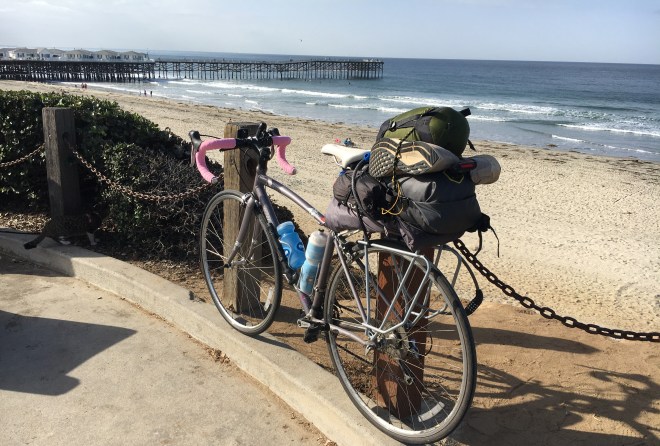
Any who, if you are cycling I recommend a visit to Pacific Beach Bikes because they are awesome! Tune up is quick and good price…all other gear was also a great price…They helped me out before heading up the coast and even hooked me up with free tire tube for the journey!
If cycling the whole coast, definately take the ferry over to Coronado and bike down to Imperial beach…aka, the border with Mexico! We drove down but if I had more time I’d have done it…there was a dedicated bike lane the whole way!
DAY ONE
San Diego to San Clemente * 57 miles
Monday morning, October 26, 2020 I headed up the Pacific Highway (PCH)/Historic Route 101 and through La Jolla, up to Oceanside then finally arrived to San Clemente after plenty of adventures.
La Jolla for me was very confusing to get out of because it is this land mass that juts out and the PCH does funky stuff to get through it…and somehow I never saw signs to follow it so I ended going up some hills I didn’t need to take but the views were nice and I saw UCSD (the Univ.) so really it’s not much of a complaint. Ha ha
It was smooth sailing pretty much all the way up to Oceanside and I loved the little towns I passed like Encinitas, Luecadia and Carlsbad!
In Carlsbad I stopped for a smoothie and while I was there a guy chatted about how he wanted to do the ride I was doing. He said “But how do you get by the base?” I said “I’m pretty sure there is a path around it”…thinking about the map and where I had to go around Laguna Beach.
Turns out he was talking about Camp Pendleton which is right after Oceanside and literally it takes the whole coastline for many miles and there is only one way and that is through the middle.
As I got to the end of Oceanside I was thrown gently onto the freeway. I knew I had to take it for a few miles to the next exit Las Pulgas. I was all excited to reach it because first the freeway was I-5 one of the largest in the nation which I’d never ever bike on at home and second because Las Pulgas reminded me of Latin America because I went plenty of times to the Las Pulgas market…Aka flea market. When I got off I headed to the base where I would continue on the 11 miles of the Camino Real. At least that is what I thought, but they don’t let you pass unless you have military clearance…which you can get if you have time and know this before hand…neither of which I had….instead I did as the Strava segment I later saw said “Kicked off the base, riding the I-5 freeway”….spot on Strava…Omg I laughed so hard when I saw this…literally how it felt!
So I biked 17 miles from Oceanside to San Clemente basically on one of the largest freeways in the US…I never thought that would ever happen. I got 4th place on that Strava segment by the way and I got to take photos of military base activity which you can’t do on base so…thank you I-5 lol! I was so dirty after riding I-5…I had a lot of black dust/dirt on me…from tires, asphalt, exhaust maybe…whatever it was…disgusting! Also plenty of things to go around on the shoulder was not easy with such speed right next to me.
Before leaving Oceanside I had taken a photo of the bike and I overlooking the beautiful pier. It was my last photo as a virgin lol before jumping on and riding Interstate 5 like a badass. Ha ha

Yup, so I arrived to San Clemente after a brief stop at Trestles Beach to watch some surfers ride California’s best waves. Surfers came in all directions, walking, skateboarding, biking etc and it was actually pretty cool to watch even as a non surfer.
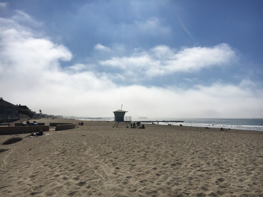
Finally, I made it to my campground for the night (San Clemente State Beach)… I asked if there were spots available and the cost, the guy at the booth said $40…I was flabbergasted to hear this when I arrived after biking 60 miles to get there. I thought bikepacking came with different rates….The guy was new apparently so I’m glad I asked because he said “I guess I can charge you the $15 bike/hike fee…but let me ask my manager” He got approval from his manager then turns to me and says it will be complementary camping for you! Awesomeness dude! This was the only time it was free, but hell of a good way to start my trip! Thanks dude!
If you are bikepacking/touring nearly every California state beach/park has bike/hike sites and they usually are $10 a night…if the campground is very popular like this one then you might expect $15 a night. Then again you might get away with wild beach camping some places…in Santa Barbara the homeless seemed to get away with doing so front row in the best spot ever (the beach)!


DAY TWO
To Newport Beach * 44 miles
As usual camping you wake up pretty much when the sun does. I took advantage and decided to head out for a run along the beach and check some of the city out. Omg I was so glad I did just that…the beach is located below some cliffs and there is a path right there. The lighting of early am on these cliffs was just dazzling! One of those runs that are magical and memorable…you pass the pier and run over some bridges…I only planned to go to the pier…5k RT but I went all the way to the last parking lot…10k done and very happy…even my neighbors at camp wished they joined me (as they sparked a convo. with me when I returned about multisport ha ha).
Morning started off well…I even got breakfast at Gauchos Tacos…I had one the night before and they were delish so I returned for the breakfast one…omg don’t miss this place! So good, I think they have multiple locations…I swear I saw one again further North.
From the campground my ride took me around Laguna Beach through Irvine. You can go through Laguna but if not early the PCH becomes like a highway and is best avoided on bicycle. I left around 10 am so it was late. I even found some local bikepackers and asked them, they agreed that best option was to go around.
It was crazy going through Irvine because I nearly had roads to myself with businesses all shut. Well that and I had to go through the one thing I was avoiding…wildfires.
As I approached Irvine you could see the plumes of smoke in the air heading West…right where I was heading. At some point I put on my generic mask hoping it would help some…or at least keep the white ashes falling, out of my mouth!
The mask did keep out ashes and it smelled better than the chared smell without it. I ended up biking with the mask the rest of the way…2 hours maybe because all that smoke was headed to Newport Beach where I would crash for the night. Funny in downtown Irvine the air quality (AQI) was actually decent compared to the beach…I looked because I was hungry but didn’t want to take my mask off…I found some trees and ate there just in case the AQI was not reading correctly. I was literally a few miles from where I saw the plumbs coming from but there was blue sky between each plumb.

Irvine Fire….headed into the smoke 😦 
smoke as I ride into Newport Beach… 
smokey sunset 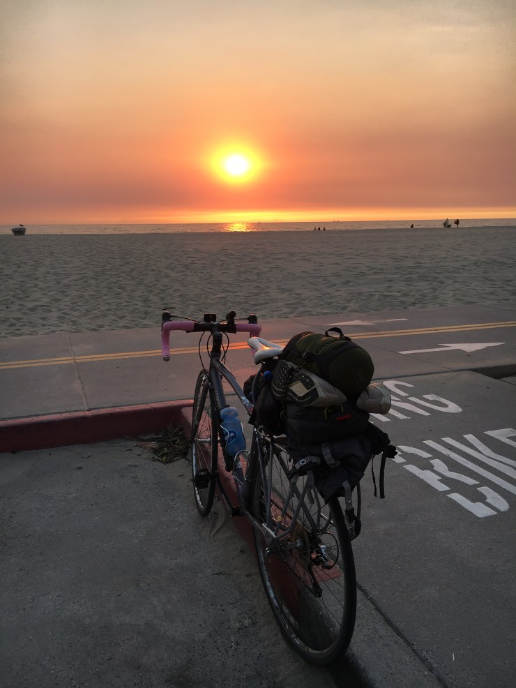
classic sunset viewing 
California Dreaming passed many streets like this and every time I thought…it´s so Cali 
Somewhere North past San Clemente…smoke is up ahead btw, cool views like this all the time 
with my friend Jaime por fin!!
The ride into Newport was all trails and I was greeted by an amazing sunset (due to the smoke). Everyone I spoke to said ¨it isn’t as smokey tonight…yesterday was awful!¨ I was glad I at least arrived on the “better” smokey day. I can imagine the day before being bad because on my ride through Irvine there were trees down which means wind was really bad and essentially the smoke too. From Irvine it was all trails which would have been great except for the smoke. The Back Bay trail entering Newport was nice and I would have enjoyed running there, if not for the air pollution.
I spent the evening catching up with a good friend from my master’s program who I’d last seen in Colombia. So nice to meet up but I wish we´d had more time.
DAY THREE
Newport to Los Angeles (LA) * 51 miles
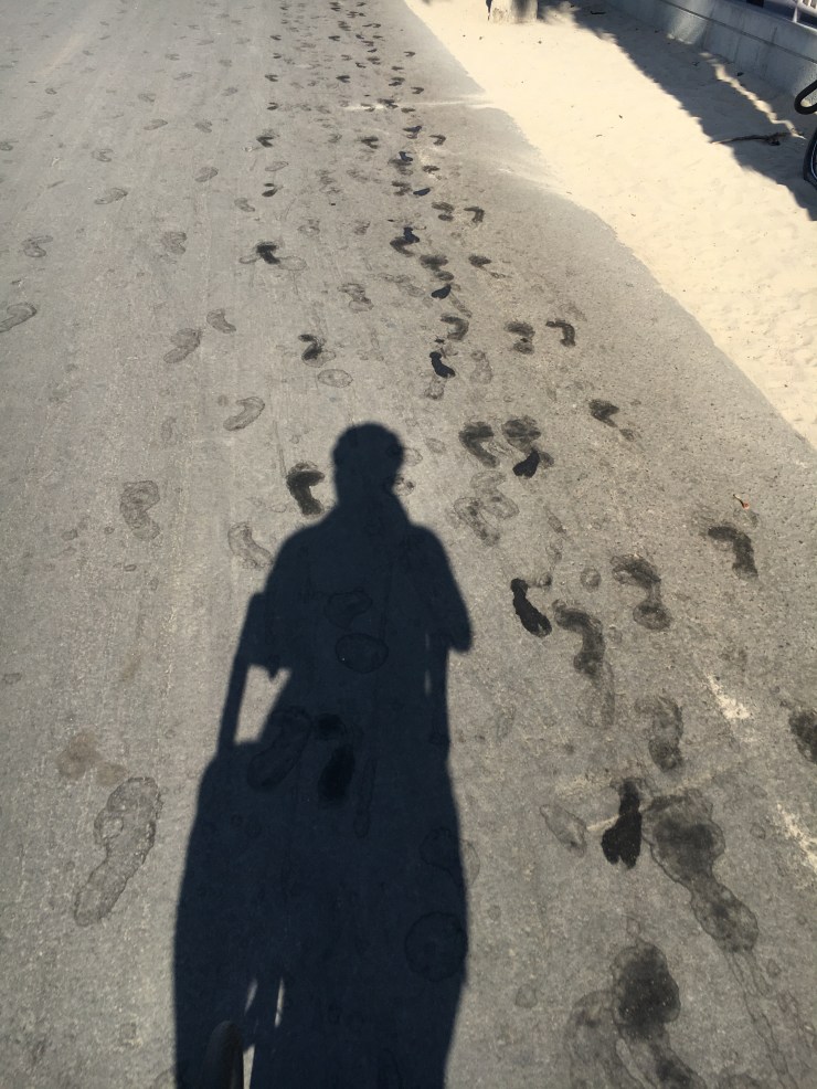
In the morning I crossed the bridge over to Huntington and immediately took the beach path. It went almost all the way to Long Beach! It was huge, as if a 2 lane road but just for exercise and literally right on the beach…very happy since the PCH is pretty busy usually and there is just a shoulder to ride here! Besides the beach I was over joyed with the simple surfer footprints all along the path as I rolled by…Huntington on up has tons of surfers!
Today´s plan was to arrive to Miracle Mile in Los Angeles to visit and stay with a friend…Basically make my way across a beast of a city! Los Angeles (LA) is the second largest in terms of population in the US (after NYC), largest in size (miles squared) and it is located in the largest county in the US (by population)…a fricking beast!
There are 2 ways through the city on bike. Head through Long Beach (next city after beaches in Huntington) along the PCH or head directly through it. If you go early before traffic you might want to do the PCH, as it is the most direct (depending on destination you want to reach). I chose to go right through the middle of it…Where I was headed is right next to West Hollywood and near the downtown core debated taking the PCH but for me it added 10 extra miles to my destination. I opted for a direct shot through Compton and South (Central) LA…if you know anything you know these locations as not the safest places…especially the later…most would tell you to avoid them!
I was excited because I felt going through this part would paint a better picture of how LA really is especially compared to previous quite touristy visits of mine…or you could say just a more well-rounded understanding of the city. LA has it all just like any big metropolitan city. I found many nice areas that extended a few blocks then felt deteriorated and maybe even turned ghetto…it is a normal city, like many I have seen before…nothing that has kept me away or fearful….just you know cautious (more so at night!).
After Huntington I reached a point where the bike lane ended right at this awesome water tower house (originally a water tower, converted into a house, you can rent it out…very cool!) and headed on the PCH into Long Beach and LA County finally! The night before I watched the LA Dodgers win the World Series in Baseball from Orange County (just next to/below LA County) at a restaurant….I was surprised only 2 people cheered…it is 2020 and a local team just won the championship! All Californians should be excited…they were in the next county over…but here they are territorial and the Anaheim Angels play so literally no one cheered…incredible…be grateful for something positive people….seriously in Basketball and Baseball California has dominated in 2020…to me this is positive for all Californians and they should be proud together…but eh…it is what it is.
Any who back to the ride….as I continued into Long Beach I saw a bike path and deviated from my mapped route….lol. I took the San Gabriel River Trail following another cyclist….a trail basically just for cyclists…very narrow and next to some power plants but it got me off the road for awhile and in the direction I needed to go (a left at the Y in the trail sent me deeper into LA).
Through Lakewood and straight through Compton and finally along Broadway until right before my eyes was the Los Angeles Olympic Coliseum, stunning to see for the first time ever (especially if you´re into sports)! As I turned onto Broadway and made my way along it I noticed the neighborhoods kept getting worse (dirty, ghetto, not inviting)…Compton no longer looked bad and to tell you the truth the people of Compton really surprised me. I got a bit lost? there…well really I just had to change my route because the planned bike path was horrible there…very sad…it was scattered with lots of glass, tree roots and had narrow sections and road crossings…bummer really! While changing it I found cars literally stopped in the middle of the road and let me cross…whereas elsewhere I must wait, no one cares…instead people were very nice here…several times people waved me across…I was impressed! Somewhere in South LA I stopped to take a photo of some street art and discovered a busy restaurant so I decided it was time to eat. Turns out they had pupusas (El Salvadorean food) which I love. They were huge and absolutely delicious! This find totally made my day…plus I got to speak Spanish :D.
Traveling through LA on bike totally gave me a wider perspective of how this huge US city operates beyond the usual tourist areas I´d visited in the past. Nearly everything I experienced cycling through the city was new to me and more in depth as I could stop if desired instead of the usual car passing through it all or even through it on the freeway. Even miracle mile where my friend lives was a completely new experience and really appealed to me with it´s art deco style everywhere.

that interesting water tower 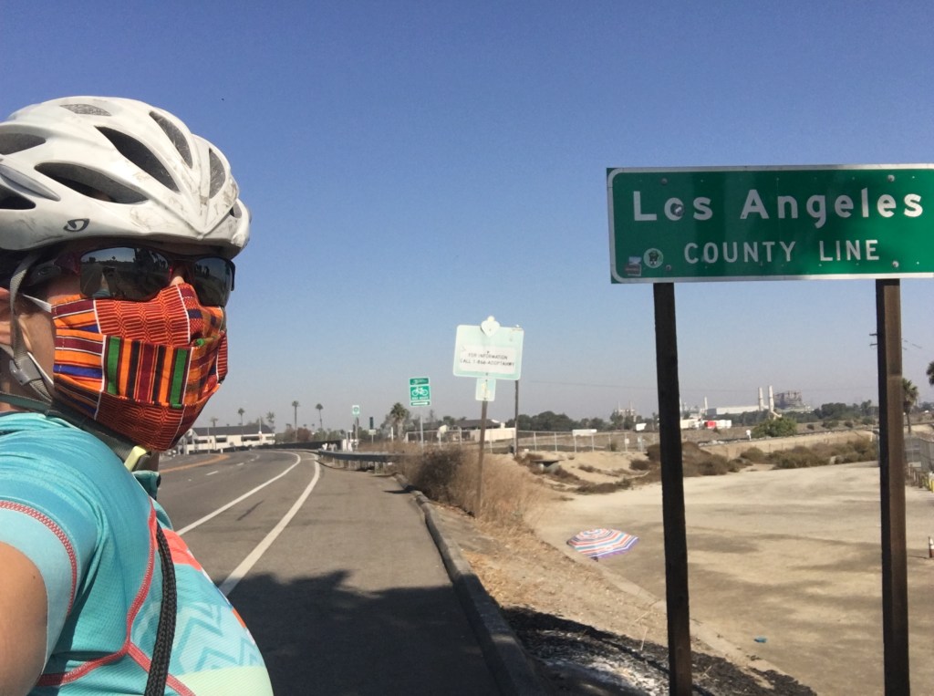
entering LA County! Achievement! 
San Gabriel River Trail 
officially in Compton, randomly found post office…so naturally a photo was needed 
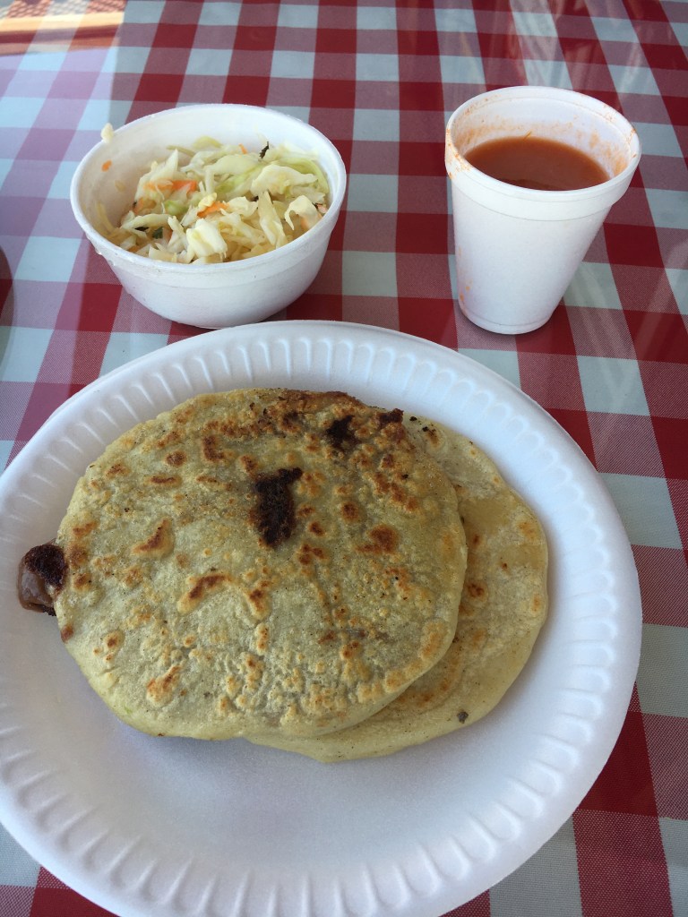
Pupusas….with beans and cheese (i think) 
super excited to arrive here…can you see it on my face? 
close up 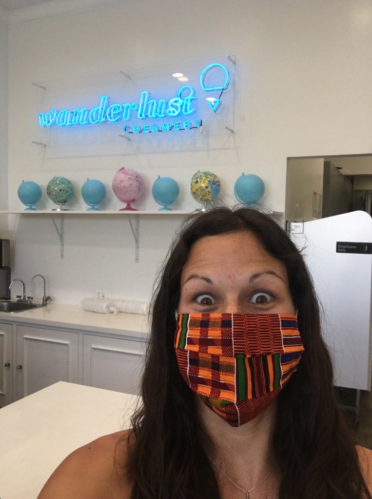
an ice cream shop just for me! flavors from around the world…and yummy too! 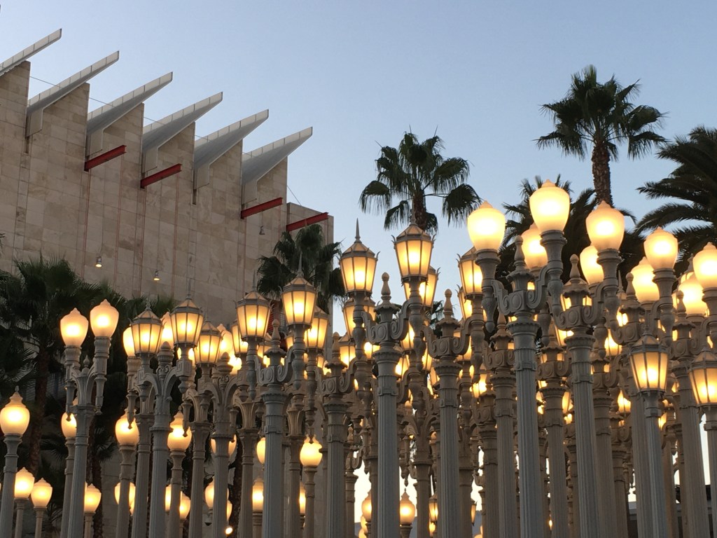
Art Museum…famous, popular photo stop
Lastly, I want to mention a bit about the Coliseum because it was for me a true welcome to LA and pure shock to have this huge stadium, of Art Moderne style (American twist to Art Deco), that was built for the 1932 Olympics right in front of me. I was drawn to it for I know how historical and motivating the place really is for many. Not only was it used in the 1932 Olympics but it´s legacy has continued on over the years to be used again for the 1984 Olympics (when the first female marathon was ran – Joan Benoit of USA took gold) and is set to welcome the 2028 Olympics!
REST DAY consisted of hanging out with my friend, having lunch at The GrovE (popular outdoor mall area), going on a run to see the neighborhood…some famous Tarpits and the Art Museum.
My friend had evening plans and mine fell through so I got some take out and binge watched the Eco Challenge Fiji all night…not the most productive but from my volunteering in Patagonia Expedition Race 2 years ago I knew a fair amount of the teams and really wanted to see how they did on the show. 😀
DAY FOUR
LA to Leo Carrillo State Beach *43 miles
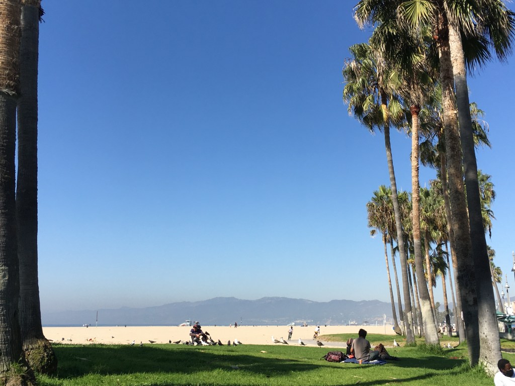
I set off around 10 am, ha ha my usual time, for Venice Beach because I´ve never been. All I had to do was take Venice Blvd. all the way down. From Venice it was an easy ride through Santa Monica and up into Malibu and beyond. The beaches have connected bike paths in the sand. I only did a portion of the trail but it goes 22 miles in total all the way to Torrence (The Strand – officially Marvin Braude Bike Trail).
It is crazy to go from Venice to Santa Monica because the vibe and feel is completely different. In fact in Venice I skipped most of the trail on the beach and did the boardwalk instead because it was just so much more lively and real. It was a pedestrian street but for the hour I went it was not jam packed and I could just ride slowly along enjoying the mainly run down stores to my right and the other street vendors to my left all while people watching and still looking at the beach. Once I hit the Santa Monica threshold I was straight up in yuppie land after the cool Latin America, semi ghetto feel. It was as if the sand even changed color…lol. These huge new looking condos appeared, playgrounds seemed different and even palm trees seemed to stand out more here. I´m not sure I liked the change, I much preferred the vibe and energy I found in Venice even if there were massive amounts of homeless everywhere!
I stopped at the famous Santa Monica Pier which blew me away because I realized the Route 66 literally ends on the pier…yes you could drive onto it…well, maybe not anymore but still…very cool, especially after my Arizona and New Mexico trip where I passed Route 66 a bazillion times! It is all wood and has the usual restaurant at the end plus a mini entertainment park (with a solar powered ferris wheel!) and aquarium. It seemed to be the most active Pacific Coast (CA) pier in terms of having stuff to do on it.
The ride today was more touristy and slow then usual since I wasn´t going too far and I really wanted to get a feel for some of these places I was rolling through….hence the 2:30 p.m. exit from Santa Monica area and onto PCH. I even did a second stop at the Malibu pier (just for a photo) and the fancy marketplace there for snacks/dinner because nothing would be available much further North.
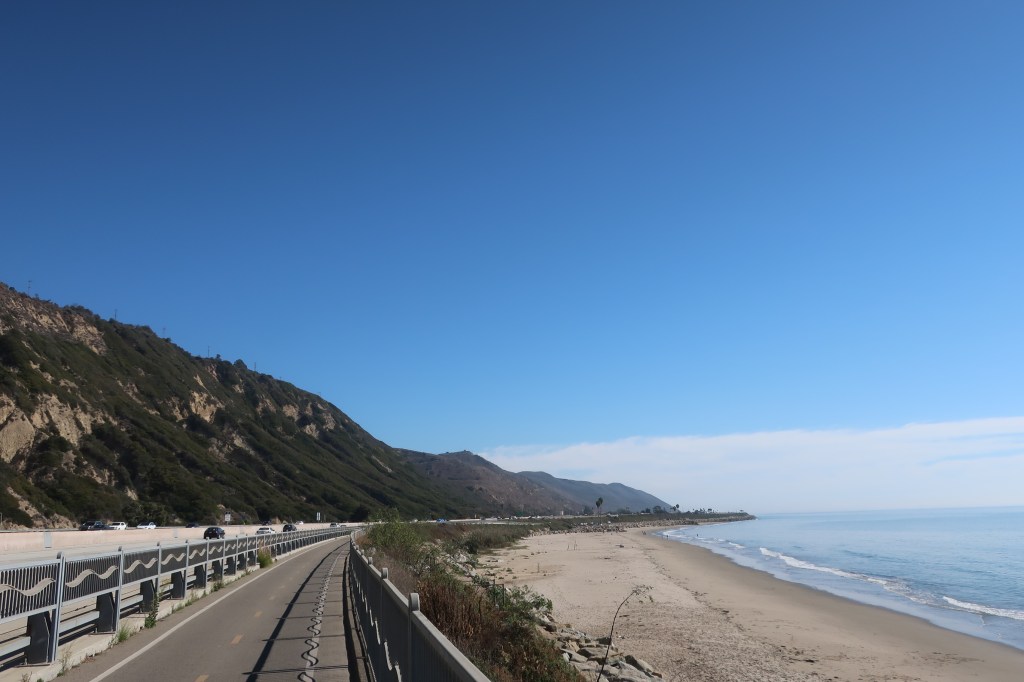
Once off the beach I was again dumped onto the PCH where I proceeded up the coast along the shoulder (when available)…..Which didn´t seem the safest overall but got a tad better once a bit past Malibu. From LA to Malibu it still felt very much like the city as it pretty much rolls off of it. Plus with the beaches so close the shoulder often get´s used for parking by surfers so you end up in the street sharing it with fast cars on sometimes curvy road. There is a lot to watch out for along this stretch…my least favorite route the whole trip was PCH to Malibu all the way to Leo Carrillo due to the amount of cars, speed of cars, least shoulder available and just careless drivers on curvy roads. Yes, worse than I-5! I am glad I went in fall and that even being a Friday the hour I jumped on it seemed pretty decent traffic wise. I highly recommend using a light (day and night) on this stretch and getting over into the lane well in advance of encountering parked cars so you can gradually as you come upon them create more space for any opening car doors.
Not too far from Malibu (15 miles) was Leo Carrillo State Beach (SB) where I would camp for a night. I was the only one camping in the bike-hike camping area but the rest of the campground was nearly full.
view from Venice of where I was headed…yup those mountains over there…the Santa Monica Mtns! 
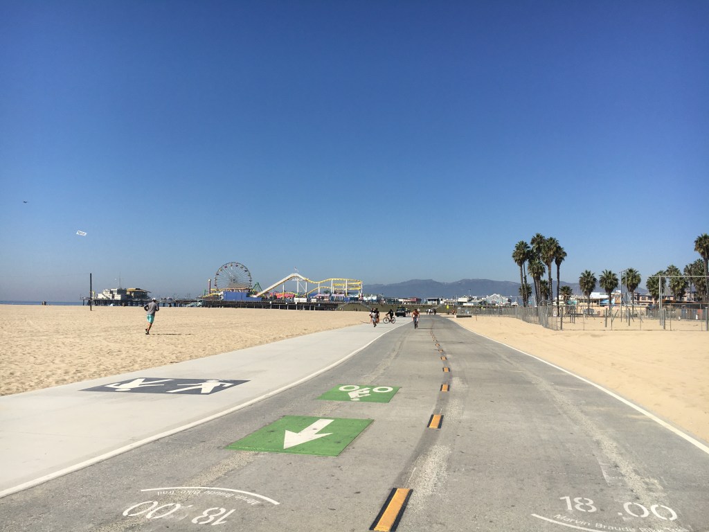
Massive bike lanes here…Santa Monica Pier in distance 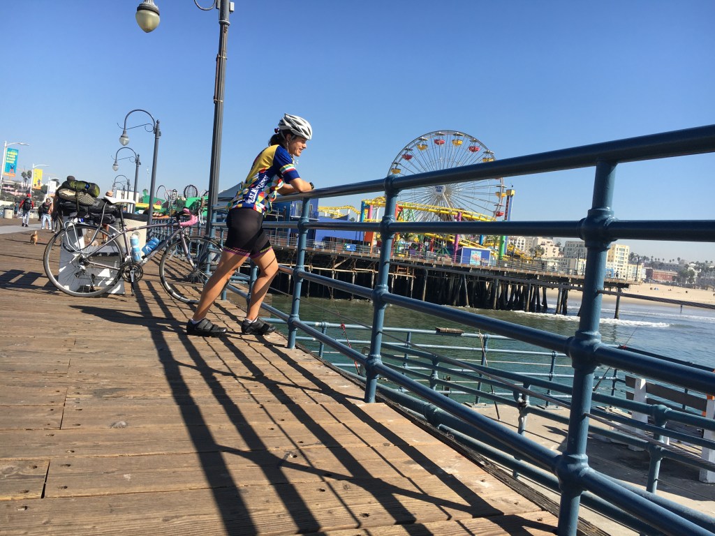
on the pier 
had to get at least one photo with the PCH sign 
Leo Carrillo tidepool finds Interesting sea anemones are blue in CA….white or green in PNW (Seattle) 
tent views
In the evening I went to the beach to eat, wander and watch the sunset then when the sun went down I wandering around the campground looking at the Halloween decorations other campers had put up and charged my phone on an empty RV hookup. It was almost a full moon and the campground was lively and festive. It was fun to see that those camping just brought Halloween along with them….I never would have thought this happens.
DAY FIVE
Leo Carrillo SB to Santa Barbara * 71 miles
My last day was my longest day and it was filled to the brim with activity. A Saturday that was also Halloween, I started early.
I did a morning run to see the beach again and went up part of this closed road next to the campground that looked awesome for cycling but I didn’t do it for lack of time and the distance I had to travel that day. It was comforting to see many cyclist groups going up and plenty on the road heading North like I’d do shortly since it was Saturday.
The views along the PCH heading North of Leo Carrillo kept getting better and better. Following the shoulder I was right along the coastline. I wished I was actually headed South because then I’d be at the water’s edge. I continued like this until Oxnard where the road became a freeway and I popped off and took side streets into Ventura and then onto the coolest bike trail yet!
Oxnard and Ventura sent me through berry farms, Discroll berries to be exact, until I hit the marina. I had a snack here then made my way through side roads until reaching the actual trail start.

The bike trail (Rincon Bike Trail) from there was so awesome. Built a few years ago, it is a safe, literally along the coast trail that went all the way to Carpinteria! Imagine, before this trail existed cyclists took the PCH which felt like a highway in this section…soo many cars and trucks…I was very happy to be on this trail. This was my favorite section of the whole ride – Ventura all the way to Santa Barbara – because it felt so safe and was absolutely stunning. Only downside was there is basically no access to the beautiful beaches below calling your name.
At Carpinteria I stopped to eat and see it’s famous beach…the beach was packed with people… I was good just viewing it. Lunch ended up being 4 scoops of ice cream lol. Great flavors at Rori’s…found again (another day) near Sta. Barbara in Montecito and I had more ha ha.
No trail after Carpinteria but all the side roads were fine…although there was a part I went on the freeway but just a mile or so to the next exit which was fine.
Santa Barbara welcomed me with it’s beauty, oh and a Trump parade of cars. Lol Presidential Election was in a few days. I actually sent in my ballot in LA…I’d had it sent down from Seattle to a friends house because it hadn’t arrived before my trip. Any who I guess now I knew what the feeling in the county I had entered was….


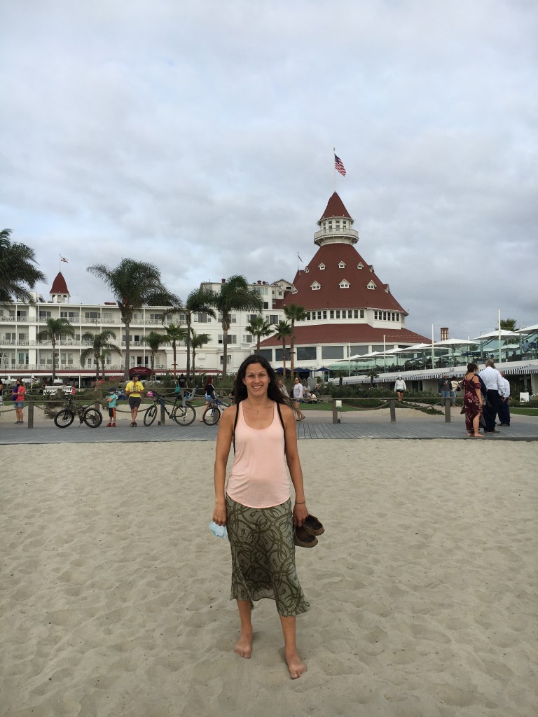
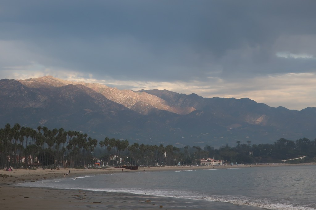
This was my first time to Sta Barbara and I was blown away by it’s gorgeousness. The palm tree studded beach with mountains in the background was something else. The blue water paired with the blue sky and often stormy looking clouds was eye catching to say the least and the pier was between it all. Wooden and you could drive on it…I later ran on it of course. I was very happy my ride ended here and I’d get a few days to explore.
So the reason I ended here was 1) it started to get cold and I wasn’t prepared to bike in much colder climate and 2) I have a friend who lives close who I’ve known since I was 10 years old but I’d not seen in maybe 13 years. A special friend who was actually my 4th grade teacher. We’d kept in touch but when I left Seattle we lost touch. Upon returning home this year I found her contact info again while digging through my stuff and we reconnected.
She picked me up in Goleta (other side of town) after I visited the famous Mission Santa Barbara and then we headed to an outdoor Halloween party! I wasn’t expecting to celebrate but she had a costume ready for me and I decided to go with the flow and enjoy some…at a distance. I went dressed as a German drindel, it was fun, felt safe and well I was the only one using a mask…but hey you must adapt and live life a little. (My opinion may differ from your’s and that is okay but I will say I did what I needed to be safe and I quarantined when returning home because I live with my family who are high risk.)


AFTER
I stayed a week up in the Santa Barbara area and did several other rides and also went to Channel Islands National Park. I highly recommend going. I did two day trips to two different islands. Would have camped on Santa Rosa but stormy days were ahead and boats got cancelled. Still worth the day trip! Santa Rosa was beautiful offering fascinating landscapes, lots of hiking and beaches. Each time we were on the boat to/from islands whales (humpback, though there are many others), dolphins and sea lions were seen! Santa Cruz island was huge, very different (cliffs and water caves galore) and offered interesting fauna. Day trips allotted 4 hours on the island…enough to do one activity…I went hiking…though kayaking was tempting.
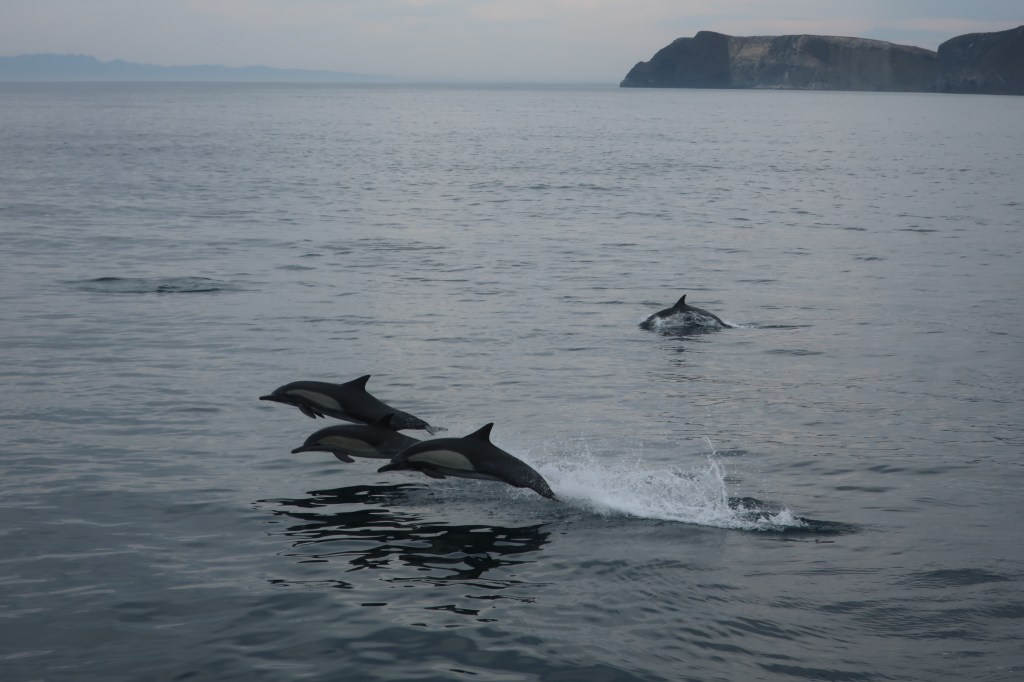
one of 3 types of dolphins we saw These are the common Dolphin 
Santa Cruz Island beaches were just wow! 
Two Humpback Whales 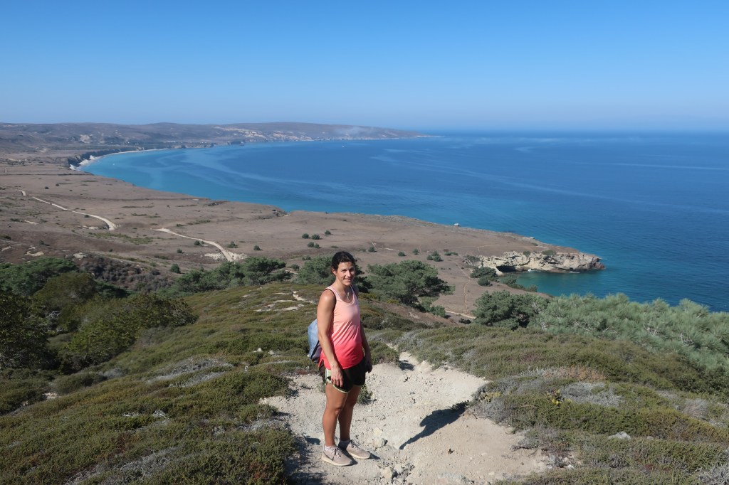
Santa Cruz Island view from above 
Santa Cruz, we got lucky with low tide so the boat entered Painted Cave…one of the deepest sea caves in the world 
tails but no breach 
Island fox…native to 6 of 8 islands that compose the Channel Islands NP
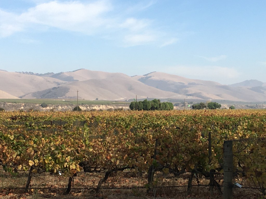
While at my friends house (in Santa Maria) I did a ride through wine country to Solvang (America’s Danish city). I rode 40 miles via Foxen Road basically to see this cute town and get some pastries. It was a lovely ride with few cars but the steady incline for the first half really sucked after running 13 miles (21k) the day before. Ha ha otherwise the steady incline was likely a breeze.


The city and region around Santa Barbara has an endless amount of great cycling routes and is known as a cycling destination. Immediately you will notice the plethora of cyclists here. If you go to cycle, know that it’s very easy to rent bikes (of all kinds) at many shops in town.
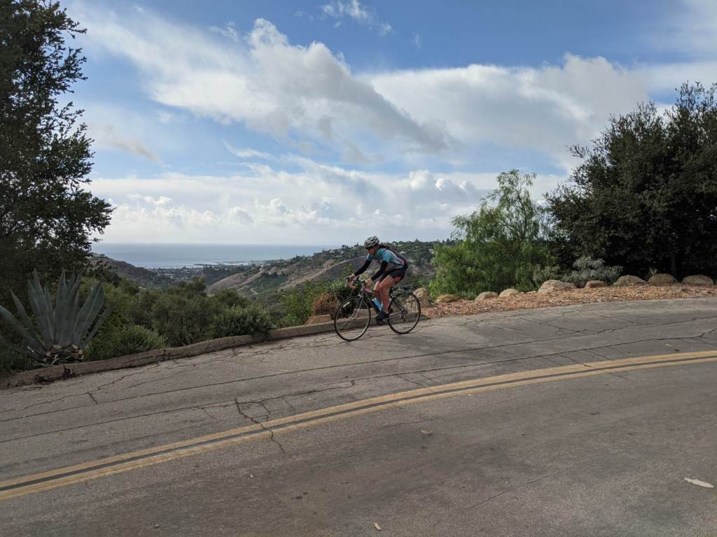
I did two rides to get to know the city and see some views. Hope Ranch loop toward the West side of town…beautiful ride along the coast for a bit then through some beautiful estates with lovely trees and fine winding downhills. Loop might be best done ending along the coast if you want more downhill…but both directions are still rewarding. (State St., Alamar Ave. (Walking bridge cross freeway), Modoc Rd., Las Palmas Dr., Marina/Cliff Dr., Shoreline Dr. into SB or reverse). The last ride I did was Mountain Drive loop toward the East. From the SB Mission you take the second road past it going uphill (must then turn left at 192 junction to catch the Drive again a bit farther up) and it was awesome…rode it down into Montecito. Don’t miss Mt. Carmel Church….the outside was beautiful…luckily I randomly rode by it. These rides were each about 20-30 miles long. Also I didn’t do it but if you want a tough climb go up Gibraltar Drive (off Mountain Drive).
Then because I’m normally crazy I also hiked Cold Springs Trail (wonderful views) after a ride :).
I Loved Santa Barbara!
Mountain Drive views 
Mountain Drive views 
The church in Montecito I mentioned btw Oprah lives in Montecito…and plenty of other Celebs…didn´t see a single one! 
Hope Ranch ride entry (exit also has this) 
Hope Ranch ride views 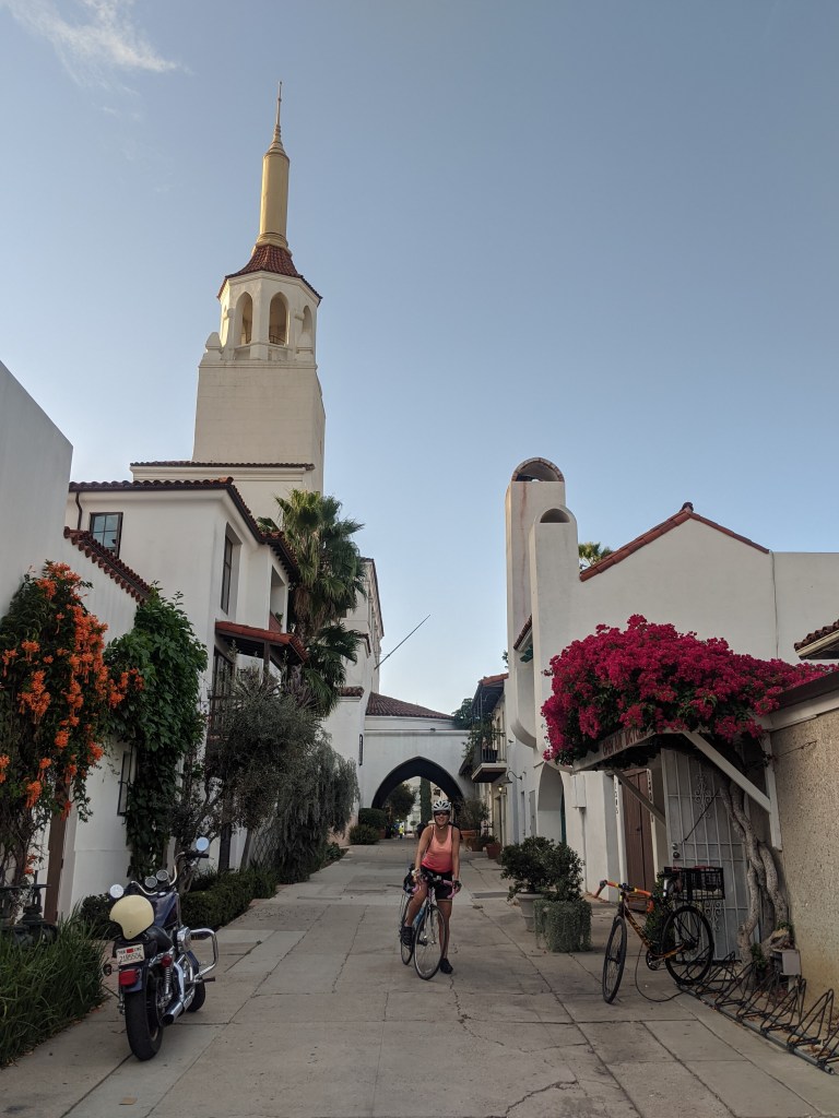
Santa Barbara classic white downtown buildings 
Hiking…views of the coast I biked (looking South)
Useful links
Itinerary to cycle Pacific Coast
Maps for cycling California Coast

2 thoughts on “Bikepacking SoCal Coast (CA)”